Top Surveying Equipment is transforming the way professionals capture data in 2025. The surveying industry is constantly evolving, and so is the equipment that generates essential data. People now largely replace traditional tools, such as manual transits and measuring wheels, with digital and aerial solutions. Combining the power of drones, satellites, and laser accuracy yields faster results with reduced need for rework.
Harper Surveying is a trusted leader in the industry. With over 20 years of service, we want to keep you updated. Here are the best surveying tools for 2025.
If you’re trying to make the most of your equipment budget and want to invest in the right tools for the job, we can help guide you to them. Learn how to compare the leading surveying tools for accuracy, efficiency, and return on investment (ROI) in 2025.
Why Choosing the Right Surveying Tools Matters in 2025
You can still perform most surveying work using traditional tools. However, the technology for to surveying equipment in 2025 saves a lot of time on each job.
First, small to medium-sized surveying firms and construction companies often work with limited equipment budgets. Making the most of every dollar starts with cost efficiency through streamlined workflows. However, it also requires measurement and data processing speed to reduce labor costs. Using the right equipment ensures your team stays on original project timelines or even delivers ahead of schedule.
Second, using the wrong equipment not only risks budget overruns but also leads to rework requests from clients. It can also cause expensive delays in your workflow. This occurs if you fail to gather the necessary data or if you take additional steps to convert and process it.
Modern surveying tools now offer options that facilitate seamless integration with construction, civil engineering, and infrastructure workflows. Your equipment should automate the addition of surveying data to planning and management platforms. This way, you can avoid tedious hand entry methods.
Select equipment that is compatible with your preferred platforms. This way, your surveying crew won’t have to learn a new workflow.

Factors for Selecting Top Surveying Equipment
Several factors influence the selection of Top surveying equipment in 2025, but a few stand out above the others. Focus on these details first:
- Project Size and Scope: Smaller lots need precise accuracy to avoid placement conflicts and boundary issues. In contrast, large infrastructure projects require both speed and accuracy on a bigger scale.
- Accuracy Requirements: Precise construction layouts need to be accurate to the inch or centimeter. Boundary surveys often prioritize speed and remote connectivity over extreme accuracy.
- Environment and Terrain: Crowded cities, thick forest canopies, and remote areas make it hard to connect. This also affects the effectiveness of GPS-based surveying tools.
- Data Integration Needs: Do you require compatibility with specific geographic information systems (GIS), computer-aided design (CAD) software, or building information modeling (BIM) platforms?
- Total Budget & ROI: Weight the purchase cost, maintenance expenses, and long-term value produced by each piece of equipment you’re considering.
- Skill Level & Training: Easy-to-use tools lower training costs and make work simpler in the field. This is especially true with automation options and strong vendor support.

Total Stations: The Workhorse of Modern Surveying
For construction crews, boundary and land surveyors, and roadwork planners, total stations are hard to beat. Total stations for land surveying are versatile tools. They provide a good mix of affordable prices and accurate results.
Use this surveying equipment to create accurate topography maps. You can also input data for 3D modeling with BIM tools.
What They Are and How They Work
A total station combines a traditional theodolite for measuring angles with an electronic distance meter (EDM). The EDM measures distances, allowing this piece of equipment to take both measurements at once with accurate lasers. The right total station makes it easy to conduct elevation readings, map land boundary points, and create structural layouts.
These surveying tools use laser measurements. They only work in places where visibility is clear. This limits their use in crowded cities, wooded areas, and on long roads that curve or dip.

Advantages of total stations:
- High accuracy and reliability, especially for angle and elevation readings
- Ideal for construction layout and boundary surveys
- Rugged designs that can handle dusty, wooded, and roadside environments
- More affordable than some other Top surveying equipment choices, including 3D laser scanners
- Robust performance in varied environments
- Extensive internal storage, export, and software integration options.
Disadvantages of total stations:
- Slower for large open areas, limiting its use to smaller roadwork and municipal layout projects
- Requires skilled operators with surveying training and experience
- Higher costs for automated total stations that speed up data gathering.
The newest total stations for 2025 have robotic designs. These robots do most of the aiming and measuring work.
If fully robotic total stations are too expensive, alternative models are available. These models offer automated workflows. They can still save time and reduce labor costs for surveying projects.
Long-range EDM models are making total station models more useful. This is helpful for roadwork, bridges, and other big projects.
GNSS/GPS Receivers: Speed Meets Precision
You may know it as the Global Positioning System (GPS). Today’s surveying tools use several Global Navigation Satellite Systems (GNSS). GNSS surveying equipment continues to gain popularity with each passing year as GPS coverage expands.
These receivers rely on satellite connections to quickly establish a large number of reference points. Making real-time corrections through Real-Time Kinematic (RTK) technology is easy. The surveyor moves the GPS receiver while it produces real-time calculations, dramatically speeding up the surveying process.
Even Trimble GNSS equipment without RTK capabilities can still give quick and accurate results over large areas. It does not need a clear line of sight.

When to Use GNSS
GNSS surveying equipment works for large-scale topographic mapping projects. This includes infrastructure projects such as roadways, highways, parking lots, earthworks, dams, bridges, and other similar structures.
These receivers are often used in commercial construction and planning projects. They provide high accuracy and quick results over large areas. GPS receivers quickly handle many land surveying and boundary reporting tasks. This is especially true in areas with clear skies but little foot traffic.
Advantages of GNSS:
- Fast data collection
- Wide coverage with fewer setups thanks to the reduced need for line-of-sight
- Real-time corrections with RTK/PPK to mitigate multipath errors from reflected signals
- Reduced crew size even on large projects
- Works well on challenging terrain, including areas with water, elevation changes, and limited access.
Disadvantages of GNSS:
- Limited use in dense forests or urban canyons formed by tall buildings
- Potential for signal interference from equipment or structures
- Dependent on satellite signals and constellation subscriptions
- Bulky or fast-draining batteries due to high power demand
Trends for 2025 in GPS Survey Equipment include support for multiple satellite networks. This will help surveying equipment function more effectively. You can achieve centimeter-level precision with many modern units.
Cloud-connected workflows send data straight to the office. This helps reduce delays and losses. Explore the top GNSS/GPS receivers available from Harper Surveying.
Drones and UAV Mapping: A New Perspective on Surveying
An increasing number of firms are choosing drones for land surveying, even smaller companies with limited budgets. These aerial tools provide value and flexibility that outweigh the investment costs. Drones can offer mapping services when equipped with the right cameras and sensors. These tools help capture accurate distance, angle, and elevation data.

Why Drones Are Gaining Popularity
Drone mapping is safer for survey crews. It is preferable to walking on land with its many hills, wildlife, or other access issues. These aerial tools quickly cover large areas at high speed, surpassing even the most experienced surveyor.
Workers spend a significant amount of time correcting mistakes and verifying data. They spend less time finding the best spots to set up equipment, like total stations or GNSS receivers. They can also work in tandem with these pieces of Top surveying equipment to support corrections or access remote areas.
Advantages of drones and UAV mapping:
- High-resolution aerial mapping
- Sensor and camera options to fit every data demand and project type
- Reduced field time thanks to both accessibility and speed
- Better coverage of hazardous terrain while protecting worker safety
Disadvantages of drones and UAV mapping:
- Rough weather conditions interrupt drone flights
- State and local regulations for drone use vary
- Drone data requires post-processing expertise
- The Federal Aviation Administration (FAA) requires professional licensing for most surveying drones
In 2025, drone surveying equipment will have new trends. These include AI flight planning services and automated cloud point generation. LiDAR-equipped drones will also be used to create 3D models of complex terrain. Compare the top drones and UAV mapping models now.
3D Laser Scanners: Reality Capture in Unprecedented Detail
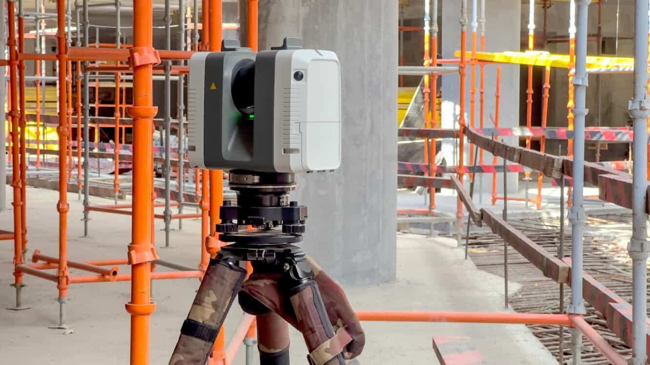
Building a skyscraper in a crowded urban environment requires millimeter accuracy. If there is a legal dispute about construction or property lines, this accuracy can help resolve it. That’s where 3D laser scanning for construction comes into play.
3D laser scanners are expensive and powerful surveying tools that provide rapid results even in challenging situations. However, they’re out of reach for many smaller firms.
The amount of data given is not needed for every surveying task. This includes simpler boundary and construction planning jobs. When you need both extreme accuracy and speed, turn to the 3D laser system.
Applications in the Real World
Creating as-built documentation can be challenging, but it is essential. It helps the property tenant or owner understand the building’s actual layout. Small changes are often made during the construction process, resulting in variations from the original plans and blueprints.
3D lasers accelerate clash detection, minimizing errors and reducing rework requests for construction firms. It’s also easy to produce digital twins with this technology that work for occupation simulations, IoT integration, and much more.
Advantages of 3D laser scanners:
- Millimeter accuracy
- Clash detection and other advanced construction planning capabilities
- Rapid data collection for complex structures
- Fastest way to capture as-built data to highlight differences from building plans
- Extensive documentation for digital twin creation.
Disadvantages of 3D laser scanners:
- Larger data sizes require more planning for storage and longer transfer times
- High upfront cost and training requirements for operators.
In 2025, significant improvements have been made in 3D laser scanning. These include better BIM integration for quick modeling. Real-time point cloud registration helps reduce the workload of later processing.
Laser devices are now more portable than before. See what the industry’s top 3D laser scanners can offer you.
Comparing Tools Side-by-Side
Compare the most popular mobile mapping systems for surveying at a glance.
Tool | Accuracy Level | Speed | Cost Range | Best For | Limitations |
Total Stations | Very High | Moderate | Mid to High | Construction Layout, Boundaries | Slower for large open areas |
GNSS Receivers | High | Very Fast | Mid to High | Topographic Mapping, Infrastructure | Signal issues in urban/forests |
Drones | High | Fast | Mid to High | Aerial Mapping, Large Terrain | Weather & regulatory limits |
3D Laser Scanners | Extremely High | Moderate | High | As-Built, Digital Twins | Data size, skilled operator needed, cost |
Buying Considerations: Beyond the Hardware
The best surveying tools for construction jobs come with plenty of after-sales support. This includes calibration services to ensure equipment operates properly and provides verification of measurement accuracy. Don’t forget about vendor training opportunities as well. No one is better qualified to train your team to use the equipment than the manufacturer or vendor.
Measure the long-term cost of ownership against the potential increased income or time savings to get the true ROI. Ensure that you include the costs of accessories, software updates, and maintenance. Don’t assume a more expensive system is always a good investment. If purchases aren’t a good fit for your small firm’s budget, rentals provide a flexible way to get the equipment you need.
Harper Surveying is committed to providing quality equipment at an affordable price. We also go the extra mile for support. Why turn anywhere else?
Upgrade Your Surveying Equipment
As automation, artificial intelligence, and digital integration continue to spread throughout the surveying field, keeping your equipment up to date is essential for staying competitive. Embrace new workflows and upgrade regularly to stay ahead.
Take the time to find the type of surveying equipment in 2025 that best fits your budget and needs for speed and accuracy. Whether you have large spaces, small turns, or require precise measurements, there is a tech tool to help. Reach out to Harper Surveying for expert guidance, demos, and product recommendations tailored to your projects.
