Cost vs. Quality: Best Surveying Equipment for Your Budget
Construction teams lose 35% of their time to non-optimal work, about $177.5 billion in U.S. labor each year.

The Z+F IMAGER 5016, 3D Laser Scanner – Zoller + Fröhlich combines compact and lightweight design with state-of-the-art 3D laser scanning surveyor technology – allowing the user to reach new levels. It’s equipped with an integrated HDR camera, internal lighting and positioning system.
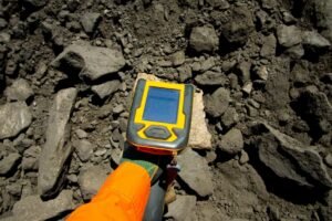
The Bruker CTX 800 Portable Countertop XRF Analyzer is a high-powered countertop XRF analyzer that comes in a compact, light and portable design.
The Olympus Vanta Element Handheld XRF Analyzer offers speed, ruggedness, and connectivity in two cost-effective models. The Vanta Element analyzer delivers affordable alloy ID, and the Vanta Element-S analyzer adds affordable light element detection.
Niton XL5 Plus Handheld XRF Analyzer is the latest portable XRF spectrometer from Thermo Scientific. Small, powerful and ultra-lightweight, it provides accurate elemental analysis in seconds directly in the field for a variety of applications.
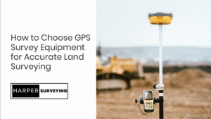
Trimble R12i GNSS System is unbeatably fast and accurate in positioning because the Trimble ProPoint™ GNSS positioning algorithm has been enhanced with the new TIP™ technology.
Spectra Geospatial Ranger 7 Designed for precision and efficiency, this advanced data collector is ideal for surveying, construction, and GIS applications.
The Topcon FC-6000 Data Collector is a robust and versatile solution designed for field professionals who demand accuracy and reliability.
The Carlson RT5 is a ruggedized Windows data collector designed for surveying, stake-out, construction layout and GIS mapping, and is bundled with Carlson SurvPC – the Windows based data collection program.
The Emlid Reach RS3 Multi-band RTK GNSS Receiver enables measurements with an accuracy of less than 20mm at an inclination of up to 60 degrees. The receiver is calibration-free and is ready to use right out of the box.
The Carlson BRx7 RTK GNSS Receiver provides reliable operation and high accuracy with the possibility of compensating the angle of inclination of the milestone, the receiver has a compact and durable case.


Harper Surveying has been a trusted provider of professional land surveying services since 1999. We understand that precision and reliability are the cornerstones of successful surveying projects.We provide high-quality tools, including modern Total Stations, advanced 3D Laser Scanners, and efficient Data Collectors.
trusted by land surveyors, engineers, and construction managers.

Construction teams lose 35% of their time to non-optimal work, about $177.5 billion in U.S. labor each year.

Every millimeter off-line at layout becomes a meter of rework down the road. And in construction, mining, or

X-ray fluorescence (XRF) is one of the most reliable techniques for identifying the elemental composition of a material