Construction projects are crucial, but managing one can be a headache. Fortunately, digital technology has experienced constant improvements and developments that make the work easier to handle. This technology includes BIM (Building Information Modelling) and total stations.
The latter is often incorporated into surveying work to record a project’s features. The traditional method involved manual work, where the surveyor rotated the instrument. Today, auto devices can use electronic data for more precise measurements. In short, total stations have changed the way projects are carried out, including in construction.
Total Station and Its Function in Construction Projects
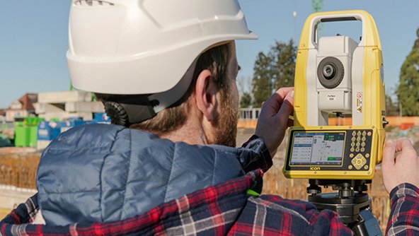
A total station is an optical and electronic device used in modern construction and surveying. The device uses an EDM (Electronic Distance Meter) and an electronic transit theodolite, integrated with an electronic data collector, storage system, and microprocessor.
The total station and its function are used to measure the sloping distance of the device toward an object, along with its vertical and horizontal angles. The microprocessor is responsible for data computation so that the surveyors can further calculate the point coordinate, horizontal distance, and the point’s reduction level.
The device also helps with data collection. Moreover, it’s good that surveyors can download the collected data (from the total station) to laptops or computers for further information processing.
Who can use this device? Anyone who needs accurate measurement of the earth’s points. This device is commonly used by civil engineers and land surveyors to set areas’ features (like boundaries, houses, or roads) or to do topographic surveying to record the features. However, it can also be used by archaeologists to record excavations. Do you know that crime scene investigators, insurance companies, private accident reconstructions, and police take measurements and exact data of the scenes?
Different Total Stations Types
In general, total stations are divided into several different types.
- Manual device. You will have to read the value (of every vertical and horizontal angle) manually, although every slope distance’s value will be read electronically.
- This is a semi-auto device. You’ll need to read the available horizontal circle manually. However, the vertical circle reading will be displayed digitally, similar to slope distance values.
- Auto (commonly known as robotic) devices are the most common. They can sense both vertical and horizontal angles automatically. At the same time, they can measure slope distance and find the coordinates of the observed points. They can even calculate distances in vertical and horizontal elements.
Every device needs to be set up. When you measure each point’s coordinates for the survey, you must do this for a known direction (such as the known bearing, the true north, or the magnetic north). This information would be recorded in the device’s memory or through an external data recorder.
This ability means a lot for construction companies. They could position accurately and then make layout points within the construction site. Moreover, you can also get quality assurance because the built data can be sent back into the BIM model.
After learning about the total station and its function in construction, you’ll realize that different total stations have various abilities and features. Some total stations can be connected to other devices or external gadgets, like GPS receivers, for data integration. The results are expected to be detailed and accurate surveys.
Robotic total stations can be easily moved around with a single button. Operators can rotate or move the telescope without being near it. This device is perfect for projects requiring different positions to produce multiple measurements.
There are also 3D total stations that can measure distances and angles in three dimensions, giving users complete ideas and pictures of the surveyed areas.
Manual Total Stations: Its Specialty
Before modern robotic total stations were invented, manual total stations were used in various applications and fields. The device requires an operator or a human surveyor to point and shoot the instrument for each point that wants to be measured manually. Afterward, the operator must record the distance and angle measurements. The recorded data is needed to calculate the point’s coordinates.

The biggest perk of this manual device is its simplicity. The operator doesn’t need any training; if there is, it would be minimal. Using one would be easy. Let’s not forget that this device is affordable and ideal for those with tight budgets. But then again, the manual is slower than the modern and robotic one, and the possibility of human error is relatively more significant.
Robotic Total Stations: Its Specialty
Contrary to the manual device, the robotic one has a robotic arm that can automatically do the pointing and shooting (at the measured points). The operator needs to remotely control the instrument by using a (handheld) controller or a computer. It’s considered safer because the operator can be within a safe distance – not to mention that taking accurate measurements can be done in a much more convenient spot.
The biggest perk of the robotic device is its efficiency and speed. When it comes to speed, it’s faster. The chances of human error would be slim. Not to mention that it’s more flexible. You can use the device in different environments, including risky or challenging locations. If you know how to do it properly, you can program the device to follow an already-made survey plan or take measurements within specific intervals. Want to integrate it with other instruments (like laser scanners or GPS)? You can do it to have more detailed and precise data.

Naturally, nothing is perfect. The robotic total station still has some limitations. In terms of price, it’s pricier. The operator needs expertise and training, so it’s not for everyone. Users must maintain it more and be extra careful because of the complex system. That’s why this device is ideal for big projects that don’t mind spending quite a lot to buy it.
Total Station Key Features
Some winning features make this device better than the others.
- High accuracy. This device can measure angles accurately. It can reach a distance of around 2mm and 2ppm and one arc second.
- Auto target recognition: Many instruments can recognize and lock targets automatically, making precise measurements easy.
- Remote control. Some new and modern devices have remote control, making them more convenient. Users can take measurements from a far away or safe distance.
- Onboard data storage. This device has built-in data storage, allowing users to keep their data within it and quickly transfer it to a computer (or any other device) for further analysis.
- Onboard software. Many of these devices have software allowing advanced data analysis and processing, including creating maps and 3D models.
The Common Applications
Total station applications can be made in these fields:
- The device would gather data for designing and building roads, bridges, and other infrastructure projects.
- The collected data would be used for building construction, covering roofs, walls, and foundation layouts.
- The collected data can benefit archaeological sites’ study, including artifact measurement and ruins mapping.
- Land surveying. Users implement this device for land surveying, including topographic, property, and boundary surveys.
- The collected data is helpful for mine planning, as it covers the locations of mineral deposits and the layouts of underground tunnels.
Total Stations Advanced Technology
You have to admit that there have been noticeable improvements in technology, and total stations are one of the devices improving daily. You can expect today’s instruments to be more accurate and advanced. What are the general advancements in technical aspects?
- Reflectorless device. Instead of a traditional prism, this tool uses a laser beam to calculate and measure the distances. Thanks to this technology, measurements can be made without any reflector. This is handy, mainly when reflectors can be used or installed on a tree or building.
- WiFi and Bluetooth connections. Some modern devices are equipped with this feature, which enables data transfer (in real-time) to mobile devices or computers. Surveyors would have no issue sharing data or working with others on a project.
- A 3D scanning total station is a hybrid device that combines the capabilities of a total station and a 3D laser scanner. This hybrid tool can capture a 3D image of the surveyed area’s point cloud, which is beneficial for creating detailed landscapes, buildings, and other structures in 3D models.
- Global Navigation Satellite System (GNSS) integration. Some modern devices can be integrated with GNSS technology to make more accurate measurements. This is helpful for remote areas or challenging environments where traditional surveying methods are often impossible.
The Additional Accessories
Want to add some accessories for your total stations? Having them make the (surveying) process more effective and boost the device’s functionality is possible. Some of them are:
- You can attach reflective prisms to targets to improve the accuracy of the measurements.
- A sturdy tripod is crucial to ensure the total station is within budget when taking the measurements. After all, it must be level and stable.
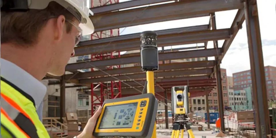
- Data collectors. The collector can be attached or connected to the device so operators can store or transfer the data. It will make the processing and analysis easier.
The Right Total Station: How to Choose One?
You can’t just pick a device and hope it works well for your projects. If you have read the previous sections, you know that each station is different. Before you spend money on a device, consider some elements.
First, consider your project and its requirements. Then, consider the needed expertise and budget. Manual methods are suitable for small-scale projects with limited budgets. Robotic methods would be ideal for large-scale projects where data needs to be gathered accurately and quickly.
Next, could you consider the technology? Total Station and its function today have advanced features, including 3D scanning, WiFi and Bluetooth connection, reflectorless, and GNSS integration. For some projects, these available features can affect the efficiency and accuracy of the surveying work.
Those are two essential elements that you can’t dismiss. They should come first when you decide on a total station. If you have more requirements or considerations, they can come later.
The most important thing about this decision-making process is to get your facts straight. You’d like to talk to the experts. Consult with suppliers, manufacturers, and professionals (the more sources you can get, the better it will be) before making any decision. These experts should be able to provide suggestions or advice about the best device based on your requirements and conditions. They can help you narrow down your options and pick the right one.
Despite the device’s wide application, engineers and surveyors mostly use it. After all, the Total Station and Its Function can provide detailed and precise data that will be implemented in various applications, including mining, land surveying, construction, and others. With all the sophisticated advancements, it’s unsurprising that total stations are becoming more high-end and better in performance.