Surveying is an integral part of many industries. It is used in mining, environmental studies, construction, and telecom. Selecting the right surveying equipment is crucial to conducting successful surveys for any project across all industries. Choosing the right tools ensures accuracy and helps avoid costly mistakes, saving time and resources.
Choosing the best surveying tools and equipment can be a challenging task. There are many options to consider.
This challenge affects professionals in all fields. This surveying equipment guide will help you understand your needs and why they are essential. This guide to choosing surveying equipment will help you make better decisions for your next project.
Understanding Surveying Equipment and Its Importance
Surveying equipment is the backbone of accurate data collection and project execution. We will explore what these tools are and why they are essential. We will also see how new surveying equipment has made work more precise and efficient.
What is Surveying Equipment?
Surveying equipment is a vital tool for measuring distances, angles, and elevations precisely. These can include instruments like total stations, GPS systems, and levels. The tools are crucial for several industries, including construction and land management.
Surveying equipment for professionals ensures accurate measurements. It reduces the risk of costly mistakes and helps meet regulations. Professionals can use essential surveying equipment to complete projects confidently, knowing their work is precise.
Why Choosing Accurate Equipment is Essential
Surveying requires absolute precision, as even the smallest errors can lead to significant problems. The best surveying tools for land surveyors minimize inaccuracies, ensuring projects stay on track and within budget.
An excellent example is surveying equipment used in construction to align the foundations. Properly aligning the foundations prevents structural failures. Similarly, property boundary surveys rely on the right surveying tools to resolve disputes and avoid legal complications. Accurate tools save time, money, and reputation for professionals across all industries who are dependent on precise surveys.
Evolution of Surveying Equipment
Surveying tools have existed for centuries, but modern surveying equipment has advanced far beyond its traditional roots. Theodolites have evolved into more advanced systems called total stations. These devices measure both angles and distances in one unit.
GPS systems now provide real-time positioning, drastically reducing fieldwork time. Innovations like 3D laser scanners allow for detailed mapping, simplifying complex tasks. These advancements demonstrate how selecting the right surveying tools ensures accuracy and adaptability for modern challenges.

How Surveying Equipment Works
Surveying equipment operates on key principles of measurement and precision, supported by technological advancements. We will now explain how these tools work and their practical applications across various industries.
Principles Behind Surveying Tools
Surveying tools measure key parameters, including angles, distances, and elevations. These measurements ensure that teams execute projects with precision. And accuracy. Key principles include:
- Angles: Measured using tools like theodolites and total stations to determine direction and alignment.
- Distances: Calculated through electronic distance measurement (EDM) devices or manual measuring tapes.
- Elevations: Levels and GPS systems provide accurate height differentials to establish elevation profiles.
These principles are the foundation of tools highlighted in any reliable surveying technology guide, ensuring accuracy in data collection and application.
Integration with Modern Technology
Advancements in surveying technology have streamlined processes and improved accuracy. Modern tools integrate software for automation and efficient data handling. Key integrations include:
- Automated Data Storage: Total stations and GPS systems save measurements digitally, reducing manual errors.
- Software Compatibility: Surveying tools work seamlessly with CAD programs for detailed mapping and design.
- Real-Time Updates: GPS-enabled tools provide continuous location data, enhancing productivity during fieldwork.
When selecting the best surveying equipment for fieldwork, look for features such as real-time updates and automation. These features can help make complex projects easier.

Real-World Applications
Surveying equipment has practical uses across industries, making it indispensable for:
- Construction: Ensuring correct alignment for foundations and structures.
- Land Mapping: Defining property boundaries and identifying terrain features.
- Environmental Projects: Providing data for conservation planning or resource development.
By understanding these applications, professionals can focus on selecting the right surveying equipment tailored to their needs. They can leverage technology for accurate and efficient results across all their projects.

Types of Surveying Equipment
Surveying equipment comes in many forms, each tailored to specific tasks. Understanding the available tools is crucial for selecting the most suitable surveying equipment.
Here’s a look at basic, advanced, and specialized tools. These tools will help you make smart choices about affordable surveying equipment in 2025. You will also explore the best options from top surveying equipment brands.
Basic Surveying Equipment
Basic tools are the foundation of most surveying tasks. These instruments are versatile, reliable, and essential for everyday projects. Key tools include:
- Total Stations: Measure angles and distances with high precision. They are widely used in construction, mapping, and boundary surveys.
- Levels: Ensure accurate elevation measurements, making them critical for construction and topographic mapping.
- Measuring Tapes: Provide straightforward distance measurements. Fiberglass and steel tapes are commonly used due to their durability and flexibility.
- Prisms: Reflect laser or light signals back to the total station for precise distance calculations, especially over long ranges.
These tools are ideal for professionals starting with affordable surveying equipment options in 2025 or handling routine projects.
Advanced Surveying Tools
Advanced tools integrate cutting-edge technology to improve accuracy and efficiency. They are essential for complex or large-scale projects. Key tools include:
- GPS/GNSS Systems: Utilize satellite signals for real-time location data, making them ideal for large-scale land surveys and infrastructure projects.
- 3D Laser Scanners: Capture detailed surface data by creating a point cloud for topographical surveys or 3D modeling.
- Robotic Total Stations: Operate remotely, offering automation and reducing the need for manual adjustments, which speeds up data collection.
These tools are manufactured by leading brands such as Trimble, Leica, and Topcon. They provide excellent performance for today’s surveying needs.

Specialized Equipment for Niche Applications
For unique projects, specialized tools offer precise capabilities. These are indispensable for industries with specific requirements. Examples include:
- Hydrographic tools are used for underwater mapping, including measuring water depth and seafloor characteristics.
- Theodolites: Measure horizontal and vertical angles. They are reliable for smaller-scale surveys and construction layouts.
- Monitoring Prisms: Used in structural monitoring to detect shifts or movements over time, critical in infrastructure maintenance.
Specialized tools are designed to cater to tasks that require accuracy beyond the capabilities of standard equipment, proving essential in unique environments.
By understanding the various options, from basic tools to advanced equipment, professionals can select the most suitable surveying gear. They can do this while considering both cost and functionality.
Factors to Consider When Selecting Surveying Equipment
Choosing the right tools requires careful evaluation of various factors. Let’s focus on the main points. This will help professionals choose surveying equipment that fits their needs, budgets, and future plans.
Project-Specific Needs
The type of project you handle will greatly influence your equipment choice. Understanding your requirements is the first step in selecting the right surveying equipment for construction or other industries.
- Precision: Projects such as boundary surveys or building foundations require highly accurate tools, including total stations or GPS systems.
- Terrain Challenges: Rugged areas might require GNSS systems for large-scale mapping, while urban environments may need compact tools for tight spaces.
- Environmental Conditions: Choose durable equipment that can withstand extreme weather, dust, or moisture to ensure reliability on-site.
You can select the surveying tools and equipment that best fit your project’s needs by considering its specific requirements.
Budget and Cost-Effectiveness
Balancing cost and functionality is crucial. Surveying equipment can range from basic tools to advanced technology.
- Initial Costs: High-quality equipment may initially be more expensive. However, it often saves money over time due to its better performance and durability.
- Affordable Options: Look for surveying tools and equipment that offer essential features at a reasonable price, especially if you’re starting out.
- Consider Renting: For short-term projects, renting tools can be a cost-effective alternative to buying.
Evaluate the value each tool brings to your operations before making a purchase.
Ease of Use and Training Requirements
User-friendly tools save time and reduce errors, making them a smart investment.
- Simple Interfaces: Modern tools with intuitive controls make fieldwork faster and easier.
- Training Resources: Ensure you have access to training programs or user manuals for complex devices like robotic total stations.
Prioritize equipment that your team can learn and operate efficiently.
Future-Proofing and Vendor Support
Investing in scalable tools ensures long-term utility and compatibility with advancing technology.
- Scalability: Choose tools that can be upgraded as your project needs to grow.
- Vendor Support: Reliable after-sales service, warranties, and technical support are essential for maintaining productivity.
Working with trusted vendors ensures your investment remains valuable over time. Considering these factors helps professionals select the most suitable surveying equipment. This equipment should meet current needs and adapt to future challenges.

Choosing the Best Surveying Equipment for Construction
Selecting the right tools for a construction business ensures precision and efficiency. Let’s look at the needs of construction tasks. We will discuss essential tools and tips for choosing the right surveying tools.
Unique Requirements for Construction Projects
Construction projects involve a range of diverse surveying tasks, each requiring specific tools for accuracy and reliability.
- Site Layout: Proper tools help align structures accurately with design plans, avoiding costly mistakes.
- Excavation: Measuring depths and determining elevations are critical for safe and precise groundwork.
- Structural Alignment: Equipment must support tasks like verifying vertical alignment and ensuring proper foundation placement.
Understanding these unique demands is key when choosing the best surveying equipment for fieldwork in construction.
Recommended Tools for Construction
The right tools can handle the rigorous demands of construction projects while maintaining precision.
- Total Stations: Offer versatility by combining angle and distance measurement, making them ideal for layout and boundary marking tasks.
- GPS Systems: Provide real-time location data, which is crucial for large-scale site planning and infrastructure projects.
- Levels: Ensure accurate height measurements for foundations and structural alignment.
These tools are staples in surveying equipment for professionals, enabling efficient and accurate data collection.
Tips for Effective Equipment Selection
Follow these guidelines to ensure you pick the best tools for your construction needs:
- Assess Project Scale: Large sites may require GPS systems, while smaller projects can rely on total stations and levels.
- Focus on Durability: Construction environments are tough, so choose tools that withstand harsh conditions.
- Match Capabilities to Tasks: Ensure the equipment you choose has the precision and range required for your specific activities.
- Consider Training Needs: User-friendly tools minimize errors and reduce the learning curve for your team.
By matching equipment capabilities with project needs, you make it easier to choose the right surveying tools. This helps improve efficiency on construction sites.
Best Brands for Surveying Equipment
Selecting tools from top surveying equipment brands ensures quality, precision, and reliability. Here’s a look at leading brands, their standout features, and some guidance on choosing the best surveying equipment for your specific needs.
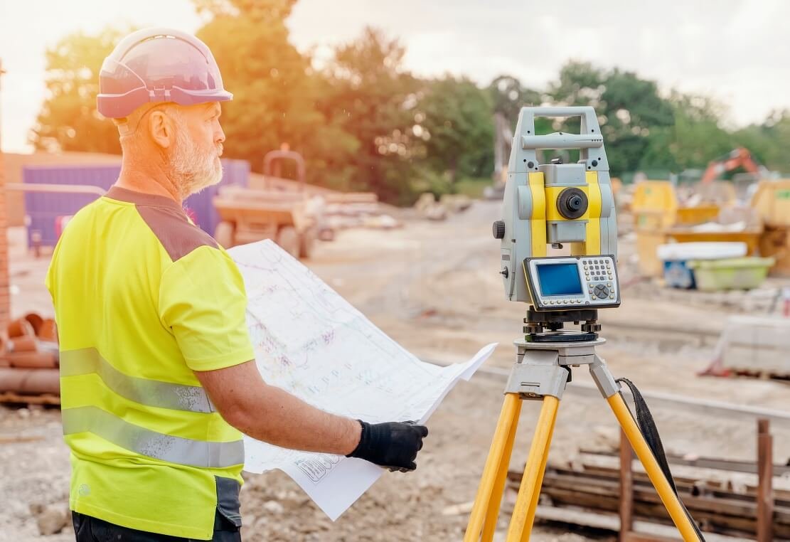
Top Surveying Equipment Brands
Trimble
Trimble is a pioneer in surveying tools for professionals, known for innovation and cutting-edge technology. Their products, such as GNSS systems and robotic total stations, are renowned for their accuracy and reliability. They are also easy to integrate with software solutions.
Leica
Leica offers some of the best surveying equipment globally, with a focus on accuracy and durability. They are known for their total stations, GPS systems, and 3D laser scanners. Land surveyors and construction workers widely use these tools.
Topcon
Topcon delivers advanced surveying solutions that combine high performance with user-friendly interfaces. Their versatile tools make them a preferred choice for various industries, including construction and infrastructure development.
Top Features of the Best Surveying Equipment Brands
Below is a comparison of flagship models from Trimble, Leica, and Topcon:
Feature | Trimble S7 | Leica TS16 | Topcon GT Series |
Accuracy | ±1″ (Angle), ±1 mm (Distance) | ±1″ (Angle), ±1 mm (Distance) | ±1″ (Angle), ±1 mm (Distance) |
Durability | IP65 (Dust & Water Resistant) | IP55 (Dust & Water Resistant) | IP65 (Dust & Water Resistant) |
Range | 5,500m with Prism | 3,500m with Prism | 4,500m with Prism |
Advanced Features | Vision Technology, SureScan | ATRplus, Imaging Camera | UltraSonic Motors, TSshield |
Battery Life | Up to 12 hours | Up to 20 hours | Up to 16 hours |
Software Integration | Compatible with Trimble Access | Compatible with Leica Captivate | Compatible with MAGNET Field |
Choosing the Best Surveying Tools for Land Surveyors Based on Brands
For Land Surveying
Choose Leica if precision is a priority. Their tools are the best for land surveyors. They provide unmatched accuracy in boundary and topographical surveys.
For Large Construction Projects
Trimble is ideal for large-scale projects that require advanced technology, such as robotic total stations and GNSS systems. Their tools integrate seamlessly with software, making them perfect for managing complex construction sites.
For Versatility
Topcon is a great choice if you need flexible tools that strike a balance between performance and ease of use. Their equipment suits a wide range of tasks, from infrastructure layout to road mapping.
Maintenance and Care for Surveying Equipment
Proper maintenance ensures your surveying equipment performs accurately and lasts longer. Here are some easy tips for daily care, safe storage, and long-term maintenance. These tips will help you get the most from your essential surveying equipment. You can also explore affordable options for replacements or upgrades in 2025.
Daily Maintenance Practices
Routine maintenance keeps your tools in top shape and prevents minor issues from becoming costly repairs.
- Cleaning: After each use, wipe your equipment with a dry, soft cloth. It will remove dirt, moisture, and dust. Avoid using harsh chemicals that could damage sensitive components.
- Calibration: Regularly check and calibrate your instruments to ensure accurate measurements. This is especially important for tools like total stations and GPS systems.
- Battery Management: Recharge batteries after use and store them in a cool, dry place. Remove the batteries if you won’t use the equipment for an extended period to prevent leakage.
Incorporating these simple steps into your routine ensures the reliability of your surveying equipment.
Protective Storage Solutions
Proper storage protects your equipment from environmental damage.
- Protective Cases: Always transport equipment in sturdy, padded cases to prevent physical damage.
- Temperature Control: Store tools in temperature-controlled environments to avoid damage from extreme heat or cold.
- Moisture Protection: Use silica gel packs in storage cases to absorb humidity, especially in damp climates.
Investing in quality storage options is a smart way to protect your essential surveying equipment and reduce wear and tear.
Long-Term Care for Optimal Performance
Long-term care ensures your tools remain accurate and functional over time.
- Professional Servicing: Schedule annual servicing with certified technicians, or as recommended by the manufacturer.
- Software Updates: Keep your equipment’s software up to date for optimal compatibility and enhanced functionality.
- Replacement Parts: Only manufacturer-approved parts are for repairs to maintain performance standards.
By using this guide for surveying equipment, you can prolong the lifespan of your tools. This will help you get the most from your investment in affordable surveying options in 2025.

Final Thoughts
Selecting the right surveying equipment is essential for project success. Aligning tools with your specific goals ensures precision, efficiency, and reliability. This surveying technology guide emphasizes the importance of selecting tools that meet both current and future needs.
Following this comprehensive guide to selecting surveying equipment, you can confidently invest in tools that enhance your work. Research thoroughly, consult experts, and prioritize quality to achieve the best results.
Frequently Asked Questions About Selecting the Right Surveying Equipment
Q. What is the Most Accurate Surveying Equipment?
A. High-precision tools like total stations, GPS systems, and 3D laser scanners are among the most accurate. These tools offer millimeter-level precision, which is essential for complex projects.
Q. How Do I Choose the Right Equipment for My Project?
A. Understand how to choose surveying equipment by evaluating project-specific needs such as precision, terrain, and budget. Match tools to tasks like construction layout or land mapping.
Q. What are the Top Brands for Surveying Tools?
Leading brands such as Trimble, Leica, and Topcon provide essential surveying equipment. They offer innovative features and reliability.
Q. Is it Better to rent or Buy Surveying Equipment?
A. Renting is cost-effective for short-term projects, while buying is ideal for long-term use. Consider your project’s duration and frequency to make an informed decision.
Q. How often should you calibrate surveying equipment?
A. Calibrate your tools regularly—monthly or before major projects—to ensure accuracy and maintain reliability. Proper upkeep is vital for selecting the right surveying equipment for construction.

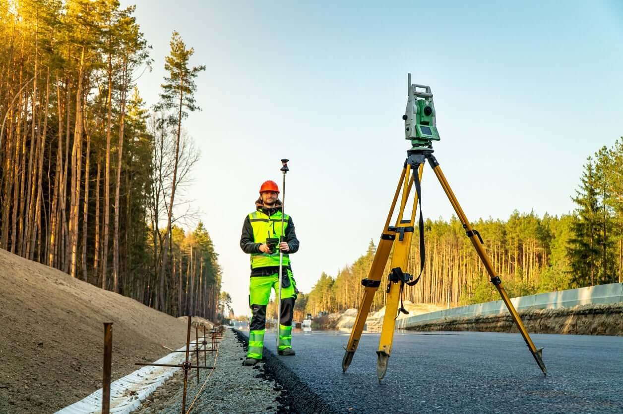
[…] in good surveying equipment and technology is important for any construction or surveying business. This helps them achieve precision and […]