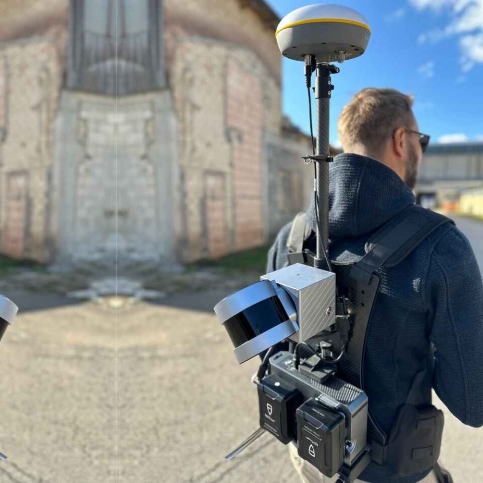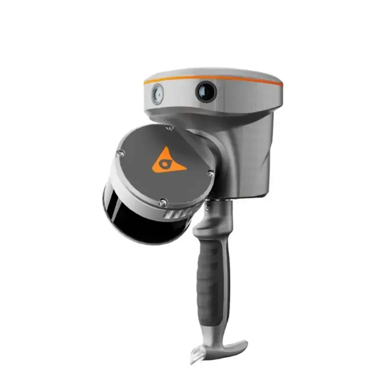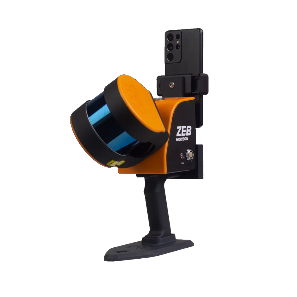
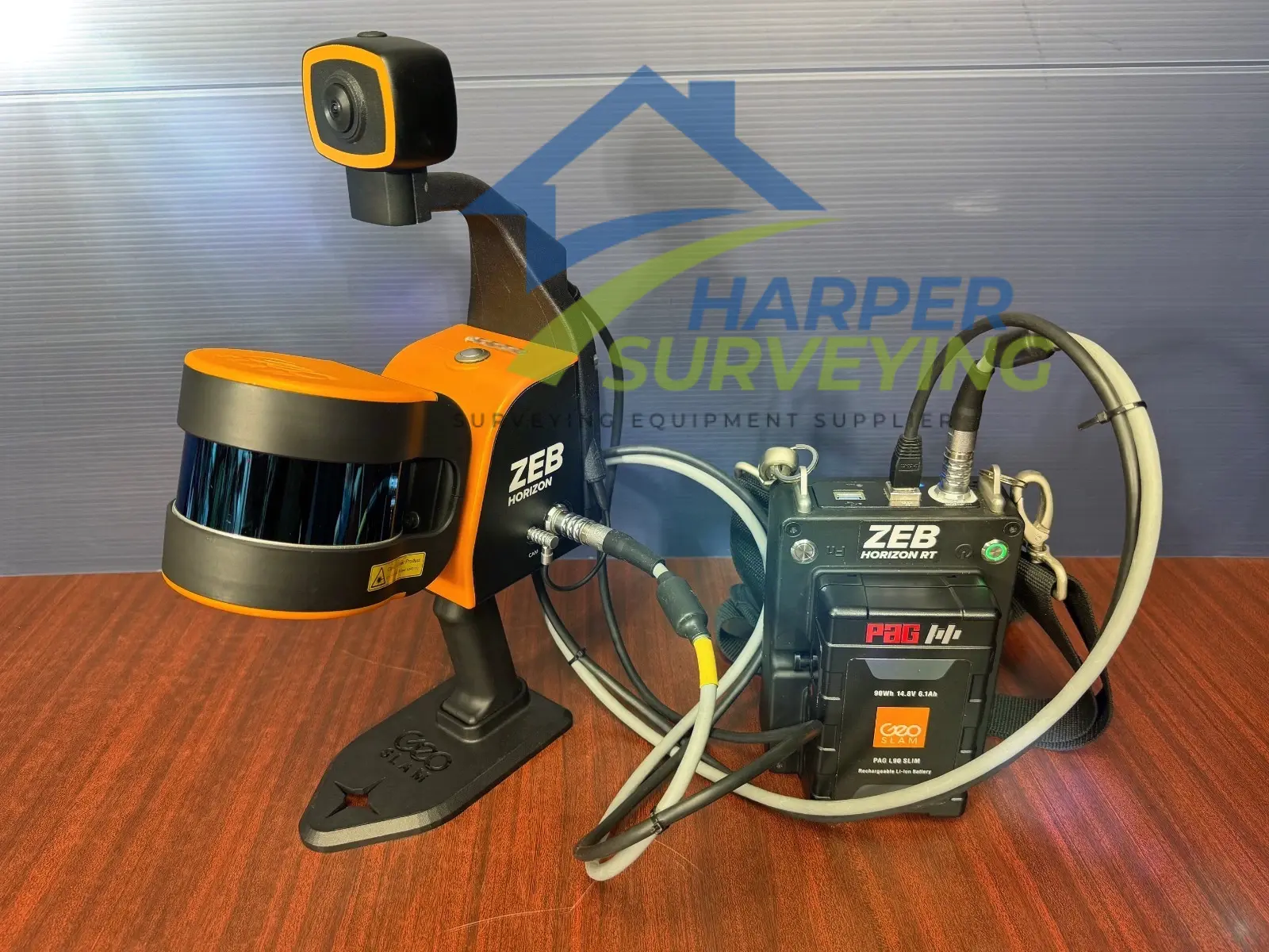
The ZEB Horizon RT, a mobile LiDAR scanner with high versatility, is the ideal solution for a variety of workflows, including both outdoor and indoor mapping. Ideal for geospatial surveying in construction, mining, or forestry, the compact design offers one tool for many applications. The real-time feedback feature ensures users capture all the data they need while on-site, resulting in cost savings and faster job turnarounds.
Powered by GeoSLAM’s proprietary and ever-evolving SLAM algorithm, the ZEB Horizon RT is the ideal solution for surveying professionals seeking faster deliverables and greater efficiency, with the ability to scan handheld or via drone, car mount, cradle, pole, or backpack.
ZEB Horizon RT Features
- 300,000 scan points per second
- 16 sensors
- Up to 6mm relative accuracy
- Up to 100-meter range
- Accessory options to enable users to capture data in a variety of ways
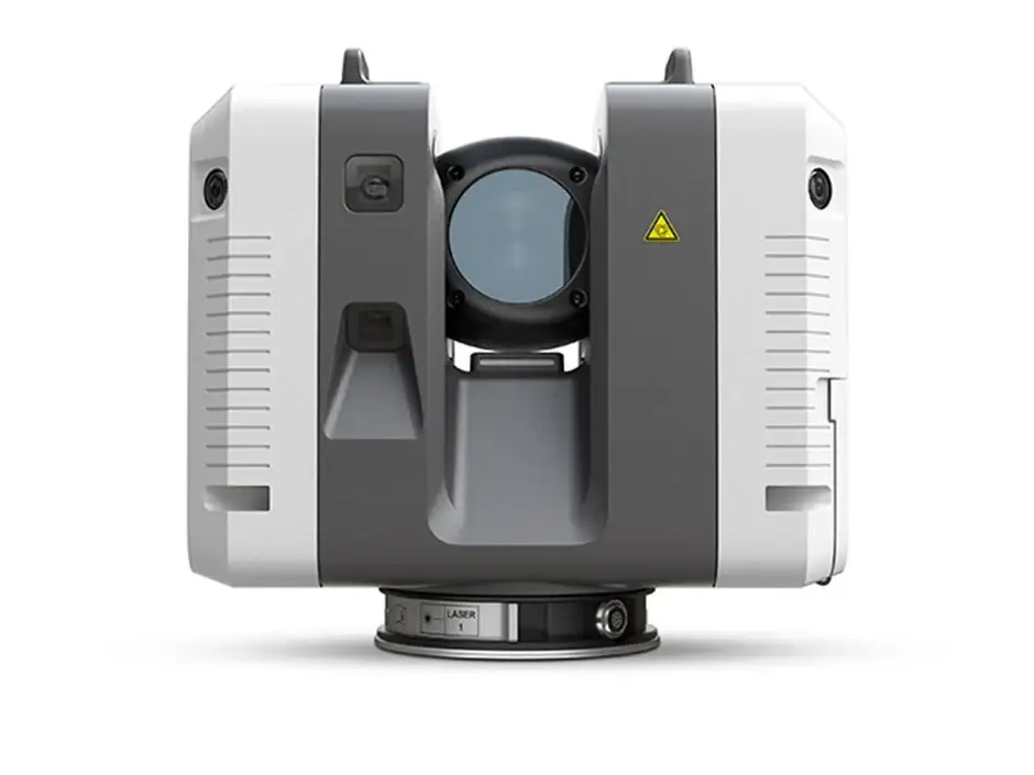
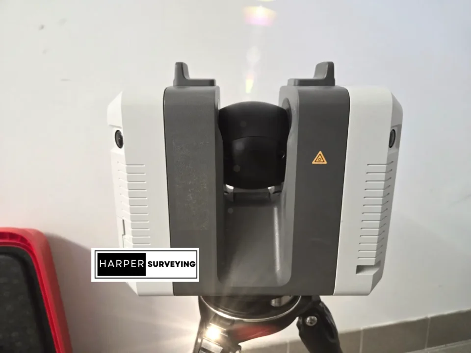
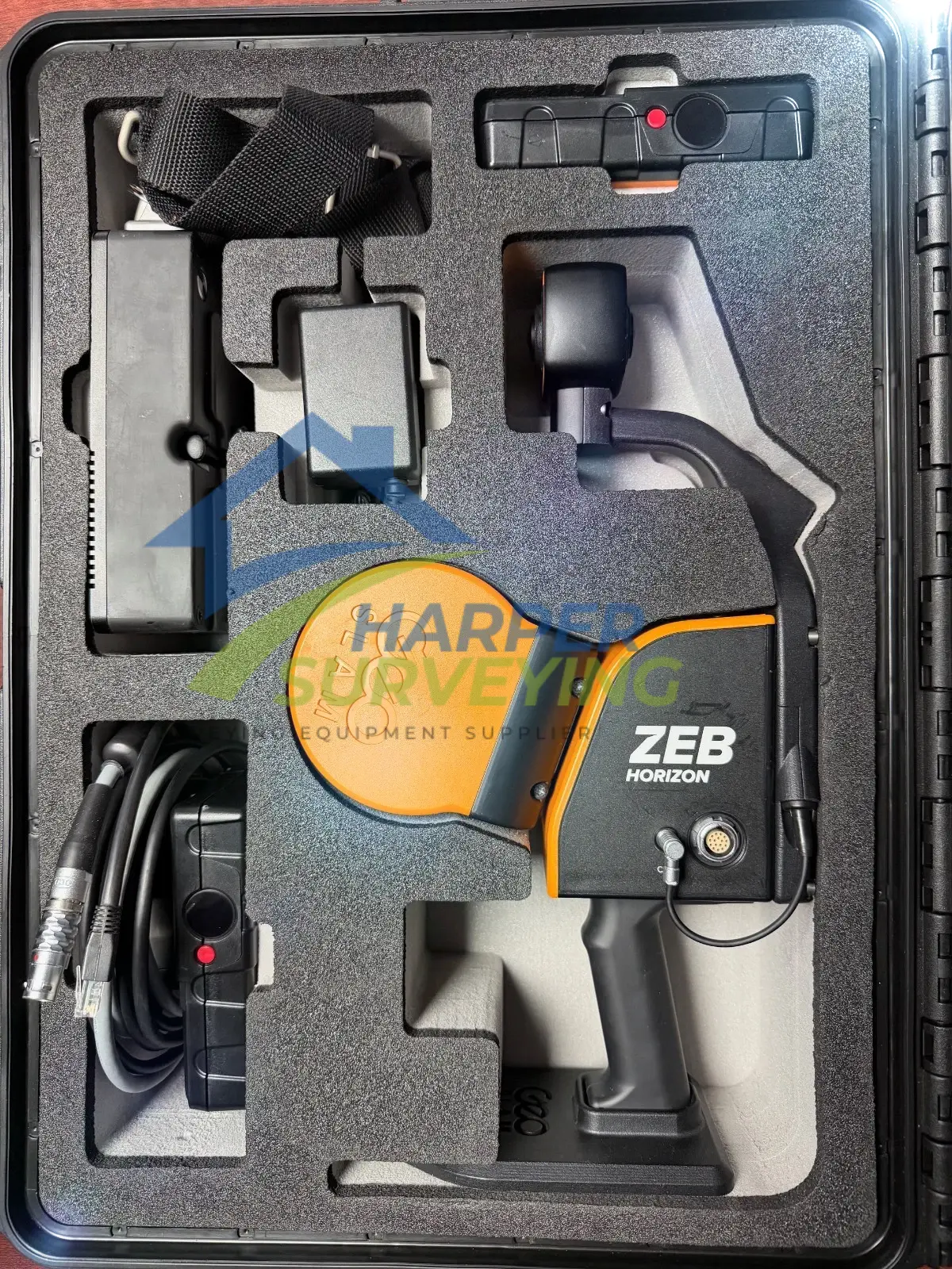
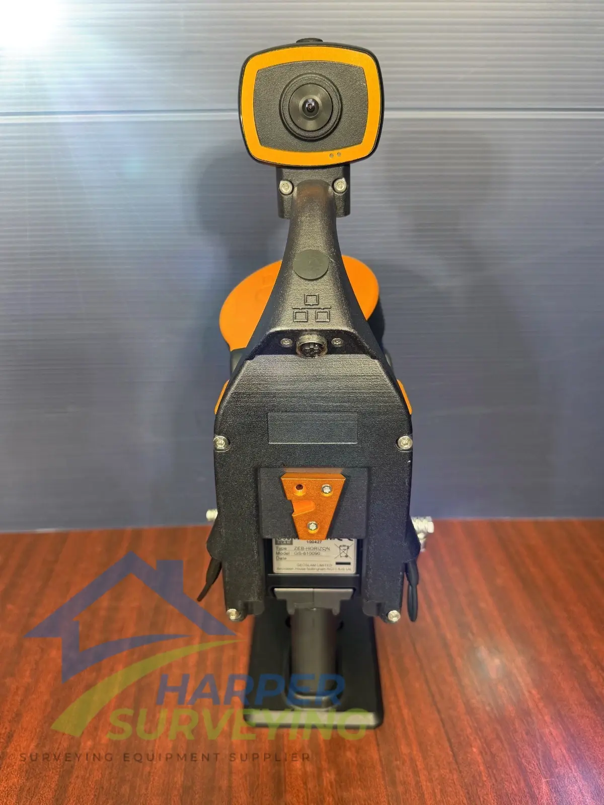
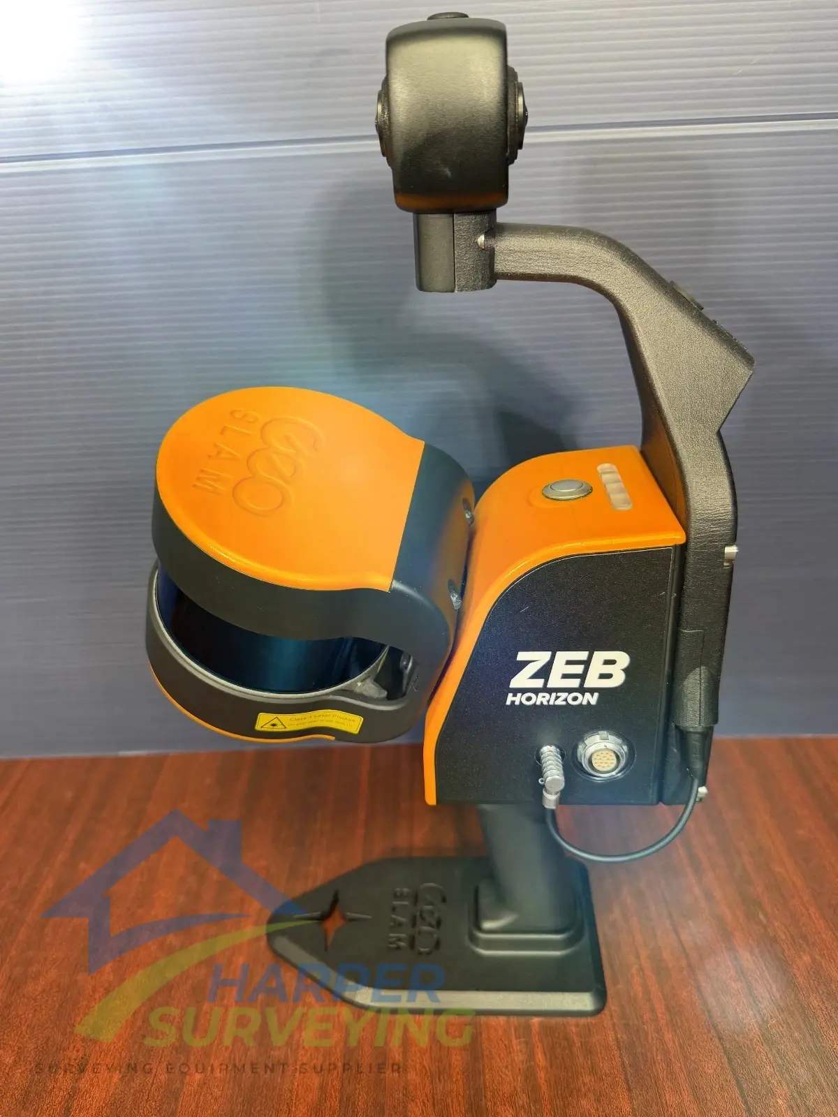
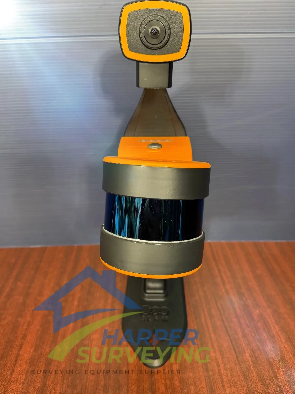
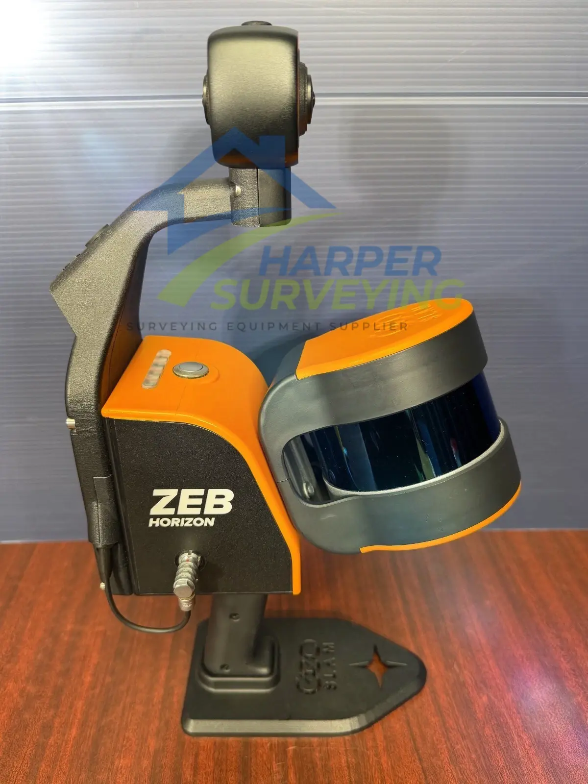
The ZEB Horizon Scanner
- Technology: The system uses Simultaneous Localization and Mapping (SLAM) technology to build a 3D point cloud and determine its own position simultaneously. This allows a user to simply walk through an environment while the scanner rapidly collects data, eliminating the need for stationary setups
- Performance: The ZEB Horizon is a high-performance scanner with a rapid data collection rate of 300,000 points per second and a range of up to 100 meters. This makes it highly efficient for mapping large and complex spaces.
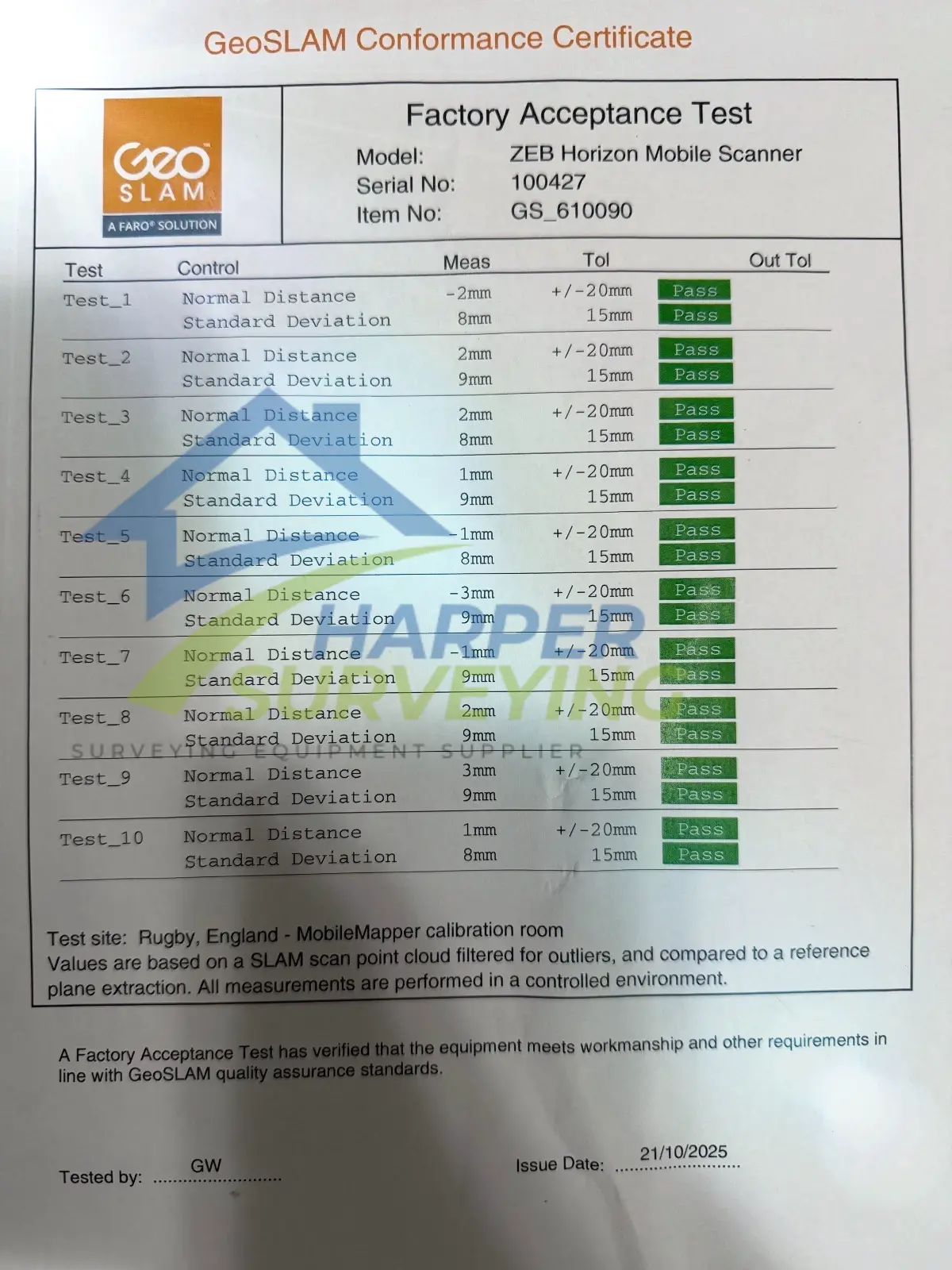
- Accuracy: It provides survey-grade relative accuracy of up to 6mm, enabling the creation of detailed, precise models.
- Versatility: The ZEB Horizon is designed to be “go-anywhere.” It can be used handheld, mounted on a backpack, a vehicle, or even a drone with an optional mount, providing a single solution for multiple applications.
- Georeferencing: The system is typically used for local-level mapping where the point cloud is self-contained. For projects that require the data to be placed in a real-world coordinate system, it can be georeferenced using a “stop-and-go” method with known control points.

The GeoSLAM Connect Software
GeoSLAM Connect is the post-processing software that accompanies the ZEB Horizon. It is a powerful platform that automates many of the complex steps involved in converting raw scan data into usable deliverables.
- Automated Processing: At the core of Connect is an automated workflow. With a single click, users can process, clean, and prepare their data. This includes applying the proprietary SLAM algorithm to align the scan data and create a clean point cloud.
- Data Filtering: The software includes tools for filtering out unwanted noise, such as stray points or moving objects, to improve the quality and clarity of the final point cloud.
- Georeferencing: Connect streamlines georeferencing by allowing users to use control points or a GPS-enabled system (such as the optional ZEB Locate) to place the point cloud in a real-world coordinate system.
- Workflow Automation: The software streamlines the entire process, from data import to final export. It can automatically apply predefined workflows and prepare data for use in third-party software such as CAD or GIS applications.
The GeoSLAM ZEB Horizon Solution with Connect is a mobile mapping ecosystem that combines a high-speed, versatile LiDAR scanner with an intelligent, automated software platform. This combination allows users to rapidly capture high-quality 3D data in challenging environments and quickly turn it into actionable information with minimal manual effort.

Applications
Mining: Rapid Site Information for the Modern Mine
The ZEB Horizon RT is an ideal tool for capturing both overground and underground data, due to its rate of data capture and range capabilities. Capture data for stockpile volumetric calculations, production progress mapping, convergence analysis, or vertical shaft inspection. Reduce risk to human life with limited exposure to dangerous environments and optimize mining operations for better returns on investment.
Real Estate: Map Properties Quicker for the Creation of Floorplans
Seamlessly transition from room to room in a property using the ZEB Horizon RT to capture all the internal data required for creating accurate floor plans. Provide a service that requires minimal effort for data capture, doesn’t disrupt residents or businesses, provides a fast, cost-efficient service, and provides a great return on investment.
Forestry: LiDAR Mapping for Rapid Data Collection and Analysis for Forest Management
Using a laser scanner, handheld or mounted to a drone or vehicle, is one of the easiest ways to capture data. Mobile mapping systems can map large areas in a short time and across rugged terrain. The data accuracy is sufficient for many forestry applications, and the ease of data capture makes it repeatable. The ZEB Horizon RT in forestry has many practical applications that range from providing data to aid precision forestry or forest mapping, to biodiversity applications such as pollution modeling and to assist carbon absorption estimations.
Architecture, Engineering, and Construction: Review Change Over Time Frequently
Ensure your AEC projects remain on track by reviewing changes over time. ZEB Horizon RT provides a method of data capture so fast and accurate that progress analysis is viable on a monthly, weekly, or even daily basis, without disrupting daily activities. Avoid heavy fines and provide all stakeholders with concrete updates on the build’s progress as often as needed. Use the change detection workflow in FARO Connect to automate this process and generate easy-to-understand reports.
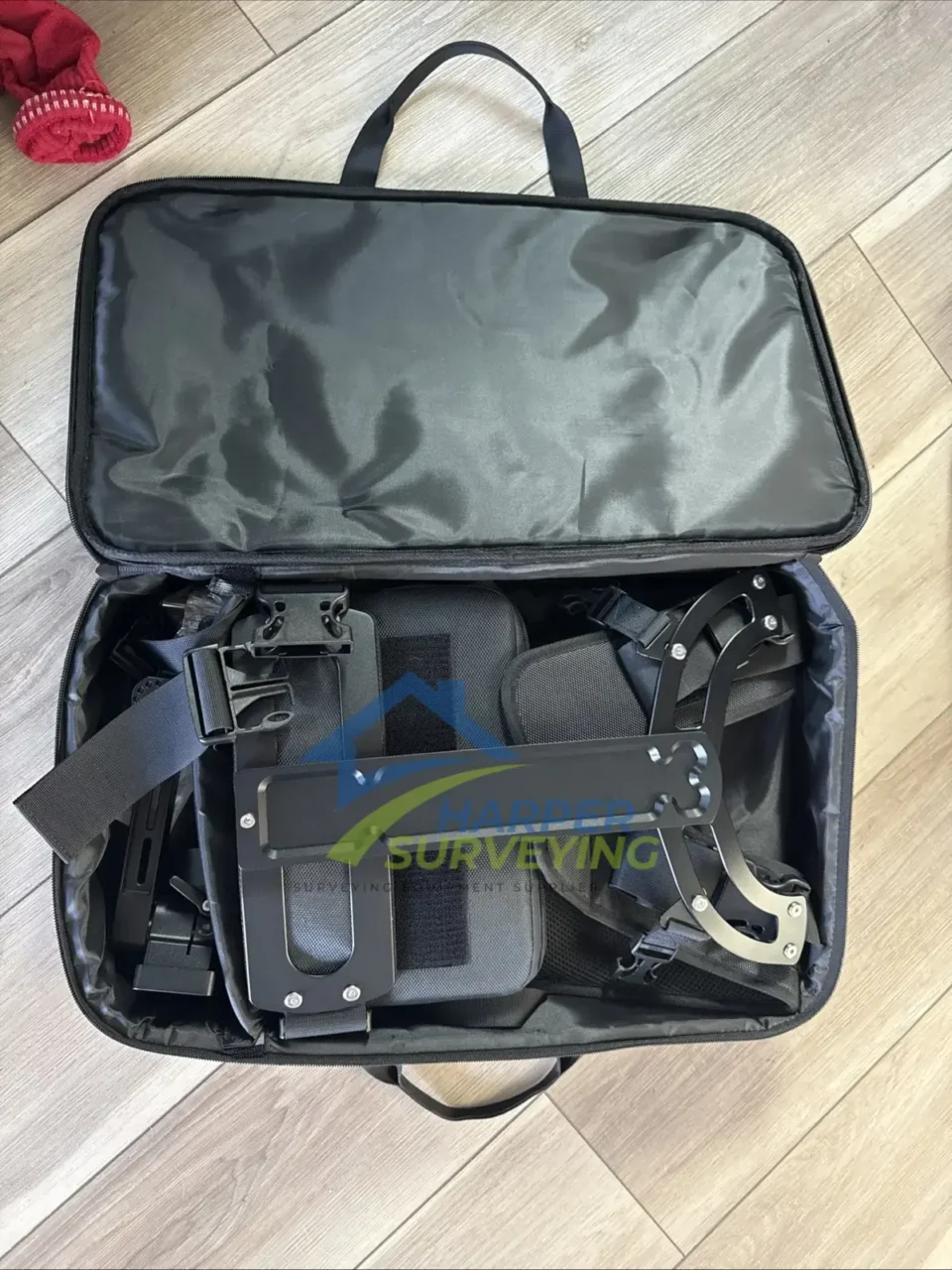
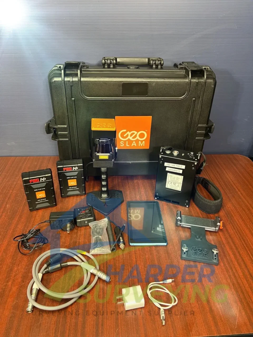
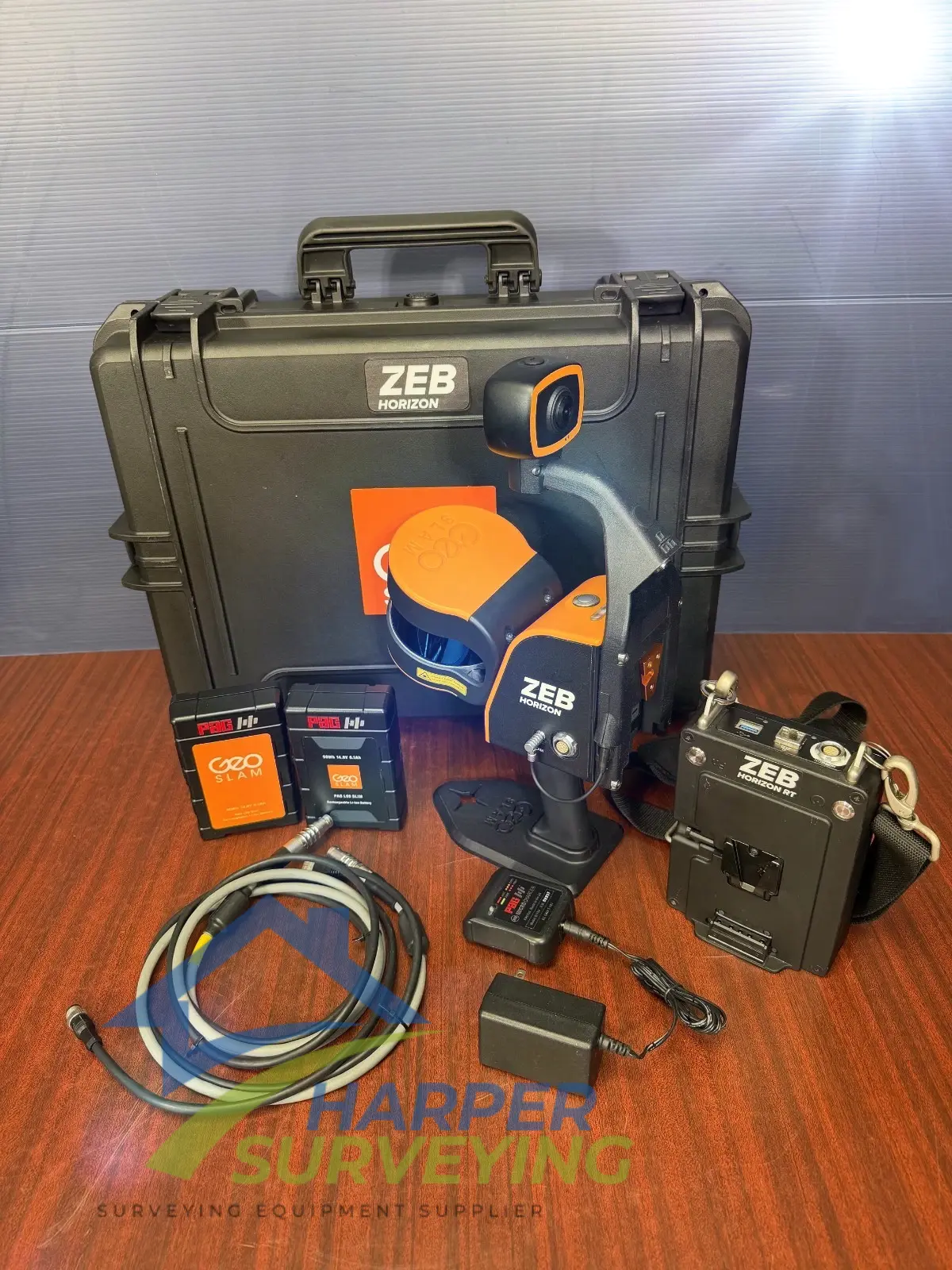
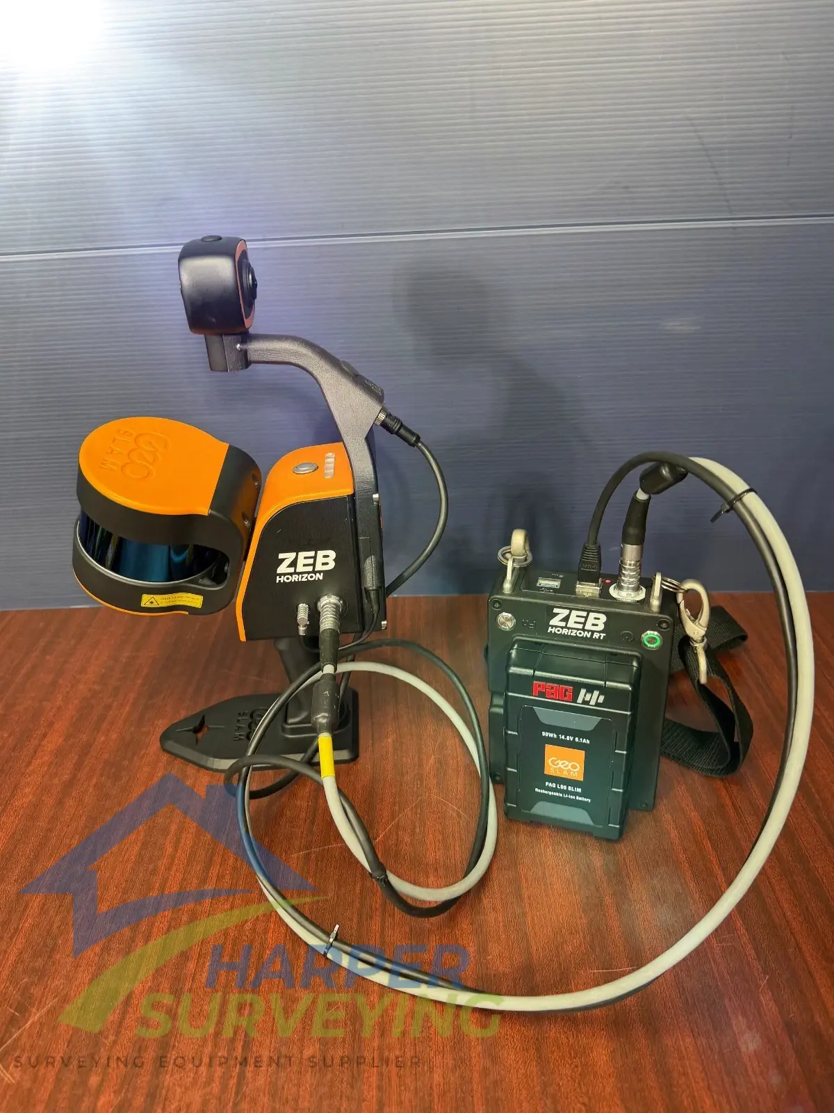
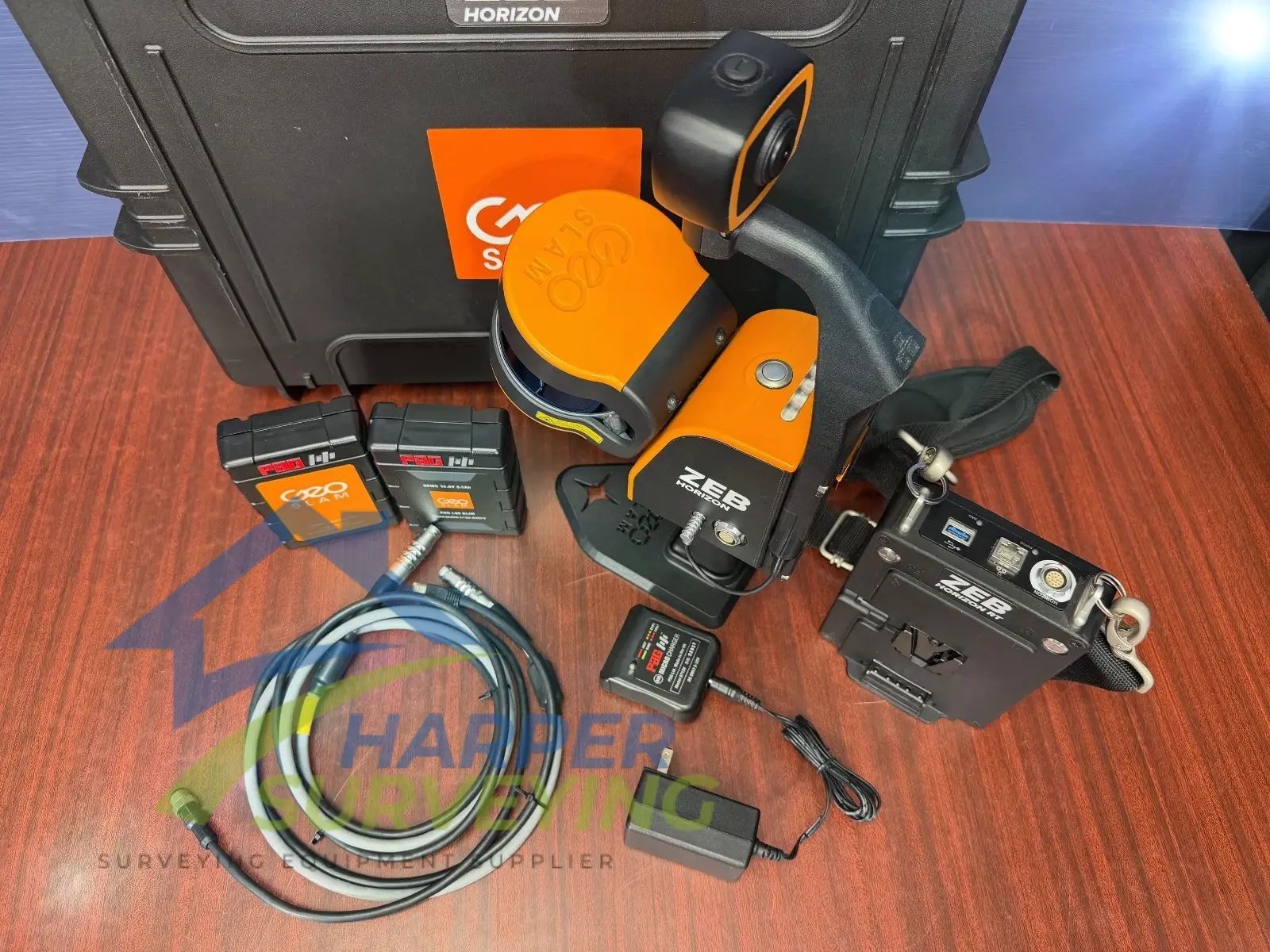
Included:
- ZEB Horizon Scanner
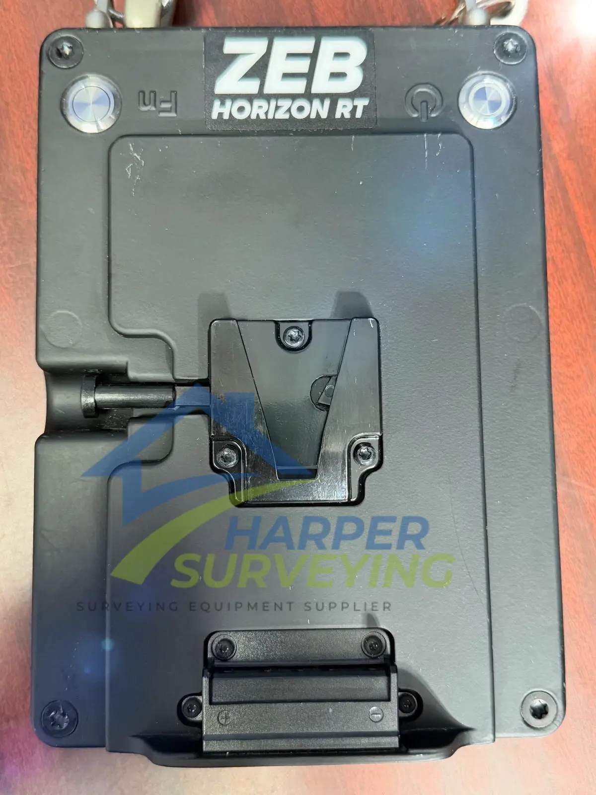
- ZEB Horizon RT datalogger with shoulder strap
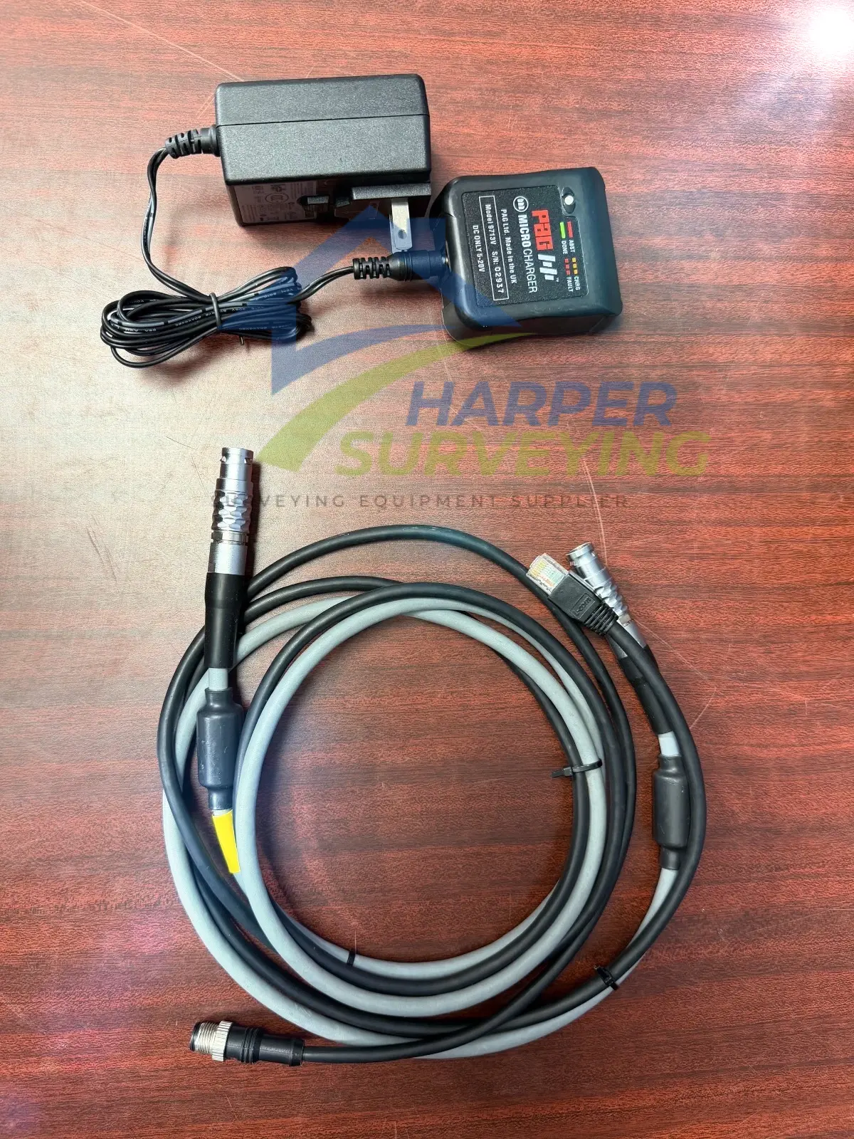
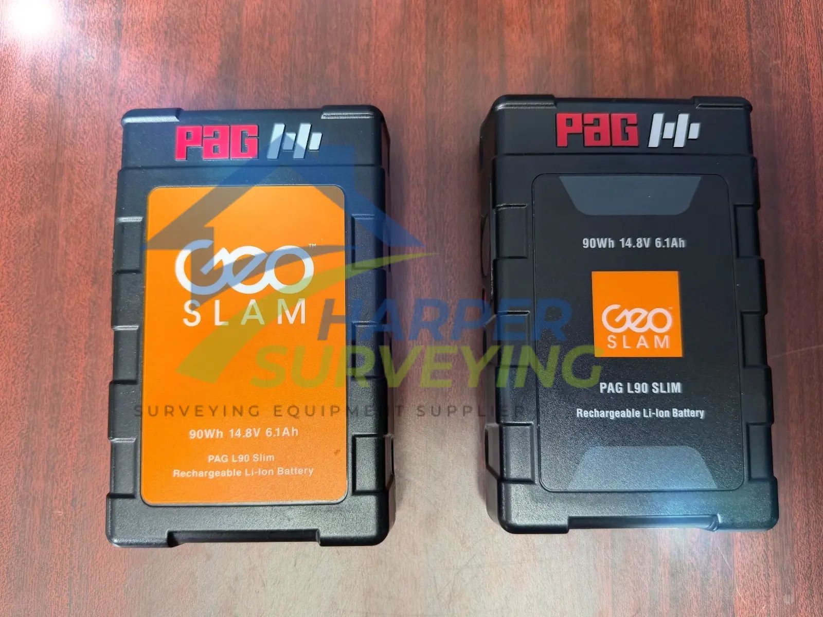
- 14.8V Battery
- 14.8V Battery Charger
- ZEB Horizon main cable (1.5m length)
- Ethernet cable (1.5m length)
- USB memory stick
- Reference base
- Phone holder
- Shipped in a soft carry case
- GeoSLAM Hub software
- 3-year hardware warranty when a valid GeoSLAM care package is purchased for each year with the option to extend to 5 years.
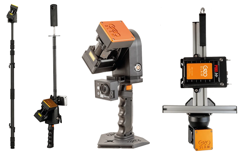
Include ZEB Horizon RT Accessories:
- ZEB Discovery: LiDAR and high-resolution imagery
- ZEB Locate: Connect your point cloud to the real world, without the need for external control points
- GeoSLAM Cradle: Allows you to mount your ZEB for vertical deployment
- Carbon Fiber Pole: This allows you to mount your ZEB for mapping at height
- GeoSLAM Guard: Provides increased protection for vertical deployment
- UAV Mount: Allows the ZEB Horizon to be mounted to a UAV
- Car Mount: Allows for vehicle-mounted data collection
- ZEB Vision: Better than ever colorization with 4K panoramic resolution
- ZEB Pano: Add 360 panoramic photography to your point clouds
Technical specification :
- Range 100m
- FOV 360° x 270°
- Laser Class 1 / λ 903nm
- Protection class IP 54
- Processing Post
- Datalogger carrier Backpack or shoulder strap
- Scanner weight 1.45kg
- Scanner points per second 300,000
- No. of sensors 16
- Relative accuracy Up to 6mm ***
- Vertical angular resolution 2°
- Raw data file size 25 – 50MB / minute
- Horizontal angular
- resolution 0.2°
- Colourised point cloud
Reference