The FJD Trion S2 Portable 3D LiDAR Scanner with state-of-the-art technology. Featuring high-speed data acquisition at 640,000 points per second, advanced SLAM algorithms, and real-time visualization, the Trion S2 is designed for precision mapping in both indoor and outdoor environments.
FJD Trion S2 boasts advanced VIO and SLAM algorithms for generating high-quality and reliable point clouds. Supporting over 8000 coordinate systems, the S2 eliminates the need for time-consuming manual coordinate conversions. By integrating with FJD Trion Scan and Model software and utilizing practical accessories like stabilizing vest, drone mount, car mount, and e-dog, the S2 enhances data capturing and processing efficiency for outdoor surveying projects.
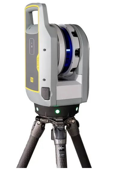
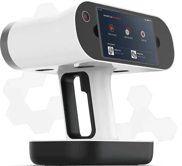
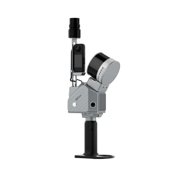
The FJD Trion S2 Portable 3D LiDAR Scanner is a lightweight and powerful SLAM-based scanning solution designed for surveying, construction, forestry, mining, and public safety sectors. Weighing just 2 kg, it integrates high-precision VIO/SLAM algorithms, dual 12MP cameras, an RTK/PPK-supported georeferencing system, and real-time point cloud processing. The FJD Trion S2 supports over 8000 coordinate systems and pairs seamlessly with FJD Trion Scan and Model software for a complete mobile mapping workflow.
Easy Reality Capture
Start a new era of LiDAR scanning with the FJD Trion S2 LiDAR Scanner—compact, powerful, and designed for precision.
- Relative Accuracy: 1.2 cm
- Scanning Range: 300m/120m
- LiDAR FOV: 360° × 270°
- Built-in camera and RTK module
- Multi-SLAM Algorithms: VIO*SLAM
- Real-time Colorization: Visualize your mission on Trion Scan
Multi-Module Integration
Integrate camera, IMU, and RTK modules into a compact form of 2kg in weight, allowing you to carry it around for various surveying projects.
Multi-SLAM Algorithms for Accurate Output
Embed two 12MP cameras to generate high-resolution images with advanced Visual-Inertial Odometry (VIO) and SLAM algorithms, delivering accurate results even in complex environments with fewer feature points.
Effortless Georeferenced Point Cloud
With an integrated RTK module, directly get georeferenced point clouds on the go. RTK & PPK support ensure accurate data collection in dense tree canopies and other signal-challenging areas. Plus, with over 8000 coordinate systems, no fear of tedious coordinate conversions anymore!
Multiple Configurations
Capture point clouds in all directions even in hard-to-reach areas with practical accessories, including stabilizing vest, extension pole, drone, robot dog and rolling suitcase. You can just go and scan anytime, anywhere.
- Drone Mount: Drone-mounted scanning system expands aerial data collection, surpassing traditional ground-based limitations. Capture large-scale data from elevated perspectives, making it perfect for building clusters, large infrastructure, and topographic mapping.
- Robot Dog: With autonomous navigation across complex terrains, it excels in construction sites, disaster zones, and underground facilities. Perform high-risk inspections with greater safety and efficiency, reducing the need for human intervention.
- Stabilizing Vest: Unique weight-bearing design significantly reduces physical burden, while ergonomic structure ensures comfort during extended operations. Maintains scanning stability even on steep mountains and rugged terrain.
- Extension Pole: The extension pole breaks height limitations. Easily measure building facades, bridge undersides, dense pipeline corridors, and other traditionally hard-to-reach areas.
- Rolling Suitcase: The rugged protective design ensures maximum security for the FJD Trion S2, whether for field operations or cross-regional projects, mobility has never been easier.
Complete Point Cloud Solution
FJD Trion Scan
Real-time scanning process control APP. Scan offers real-time monitoring to guide your scanning progress, ensuring complete coverage without rework in the future.
FJD Trion Model
Point cloud processing software. FJD Trion Model is a PC and tablet based point cloud processing solution that enables denoising, colorization, and classification. Industry-specific modules empower quick and seamless results for like floor plan and 3D model generation for construction, section analysis for tunnels, and trunk and canopy analysis for forestry.
FJD Trion S2 Application
Property Management and Assessment
Assess structural integrity, plan spaces, and identify areas in need of repair or renovation. Reduce uncertainty in investment decisions with insights from a rich spatial dataset.
Public Safety
Leverage point cloud data to enhance disaster preparedness and recovery plans. Quickly record evidence and crime or accident scenes for immediate and accurate forensic documentation.
AEC
Make more informed decisions on your projects from blueprint to QA/QC with building surveys, scan to CAD&BIM, as-built documentation, floor plans, and stockpile volumes.
Topographical Survey
Accurately map and analyze terrain features with high-resolution point cloud data. Streamline land development projects, environmental studies, and infrastructure planning by capturing detailed elevation models and surface characteristics.
Forestry and Vegetation Analysis
Manage and monitor tree inventory with a quick walk in the forest. Measure crowns, analyze breast diameter and tree height using precise point cloud data.
Mining
Use point cloud data to assess mining environments, and improve underground mapping accuracy. Enhance operational efficiency by providing real-time insights into tunnel conditions, mineral deposits, and structural integrity.
FJD Trion S2 Key Features
- High Accuracy & Resolution
Achieve point cloud accuracy up to 1.2 cm, even in areas with sparse features. - Real-Time Colorized Scanning
Dual 12MP cameras enable real-time point cloud generation and colorization. - SLAM + VIO Fusion
Multi-SLAM algorithms ensure tracking stability in GPS-denied environments. - RTK & PPK Georeferencing
Onboard GNSS/RTK module enables direct output of georeferenced point clouds. - 8000+ Coordinate System Support
Eliminate manual conversions with wide system compatibility. - All-in-One Compact System
Built-in camera, IMU, RTK, and data storage with a total weight of only 2 kg. - Broad Accessory Support
Includes stabilizing vest, extension pole, drone/car/robot dog mounts, and rolling suitcase.
Seamless Workflow Integration
- FJD Trion Scan App
Monitor scanning progress and view point clouds in real-time on your tablet or phone. - FJD Trion Model Software
Process point clouds into 2D/3D models with tools like Gaussian splatting, mesh modeling, canopy analysis, and more. Available on PC and iPadOS. - Modular Accessories
Mount S2 on robots, drones, vehicles, or wear it with a vest for maximum versatility in any terrain.
FJD Trion S2 Application
- Architecture, Engineering & Construction
Use for as-built documentation, scan to CAD/BIM, floor plans, stockpile volume. - Public Safety & Forensics
Rapid evidence capture and crime scene modeling for precise documentation. - Mining & Tunneling
Conduct underground surveys and safety inspections with point cloud analysis. - Forestry & Vegetation Analysis
Map forest structure, measure trunk height/diameter, crown spread, and canopy volume. - Topographic Surveying
Create accurate elevation models for land development and terrain studies. - Property Management & Assessment
Measure structural details and spatial metrics for renovation or risk evaluation.
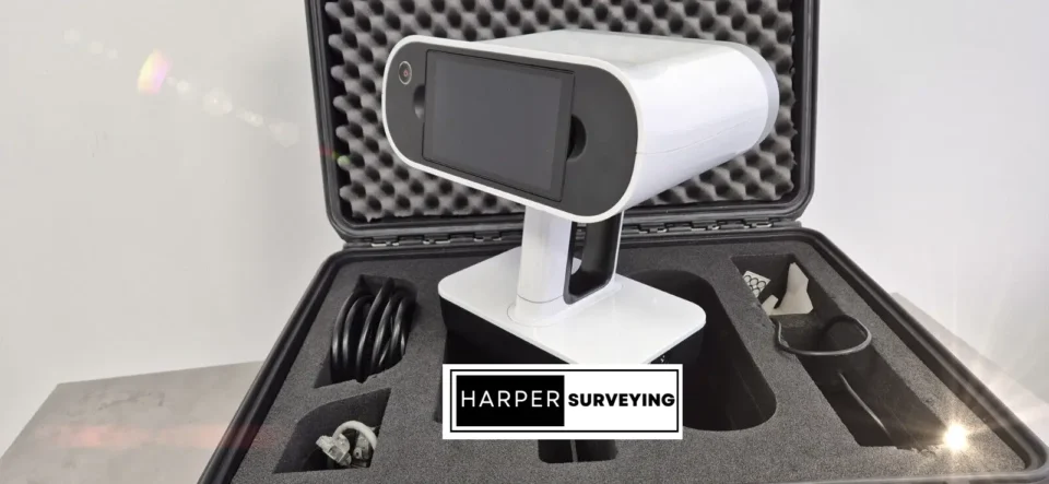
INCLUDED :
- Stabilizing vest
- Extension pole
- Rolling suitcase
- TRION Model Basic Permanent License
- 1x Carry box
- 2x Batteries
- 1x Charger
- 1x Insta360 Camera
- Mini RTK Module